The whole journey, arranged so the road stays the point.
It is not a guided trip, and it is not a track file on its own. It is the day already worked out, with the practical detail in the same place as the road.
01The whole route, stage by stage.
02Distances and realistic riding times.
03The stops that earn their place.
04Where to stay and where to eat.
05What to know before each day starts.
06GPX files for your own navigator.
Roads Unleashed21:04
The day
The day, stage by stage
First stageRoute
Second stageRoute
A key stopA wide lay-by at the roadside, with the whole valley in front of you.
The note you want before setting off: what to expect on the road, and what to check first.
An example of the day view. A real day is not published on this site yet.
The route
The stops, one by one.
Every stop in the roadbook has been ridden to and stood at. These are the ones on this route.
What each day asks of you, what to check before setting off, and where to stop for a reason. The places open into their own guide.
Day 1
Figueres - Voglans
574.8 km
Before you set off
Motorway linking day: 574.80 km and 319 nominal minutes between Figueres and Voglans, with the Spanish and French sections joined by toll. There are no editorial points of interest: the aim of the day is to gain position to enter the Alps tomorrow, not to visit. You decide the pace, the breaks and where to refuel. Use Calimoto as the master track and the Google Maps link as an ordered check; the suggested service areas are operational stops, not visits. Check tolls, fuel, weather and daylight before setting off, and remember that this edition does not include accommodation or meals.
Day 2
Voglans - Briançon
254.33 km
Before you set off
Self-guided day of 254.33 km and 276 nominal minutes. You decide the pace, the breaks and which suggestions are worth visiting. Use Calimoto as the master track and the Google Maps link as an ordered check; the stops are not compulsory. Check the road, the weather, fuel and daylight before setting off. This edition does not include accommodation or meals: arrange those services yourself and recalculate if a condition changes.
Le P’tit CaféCoffee stop
Le P’tit Café: the first stop of the day decides how the passes get climbed
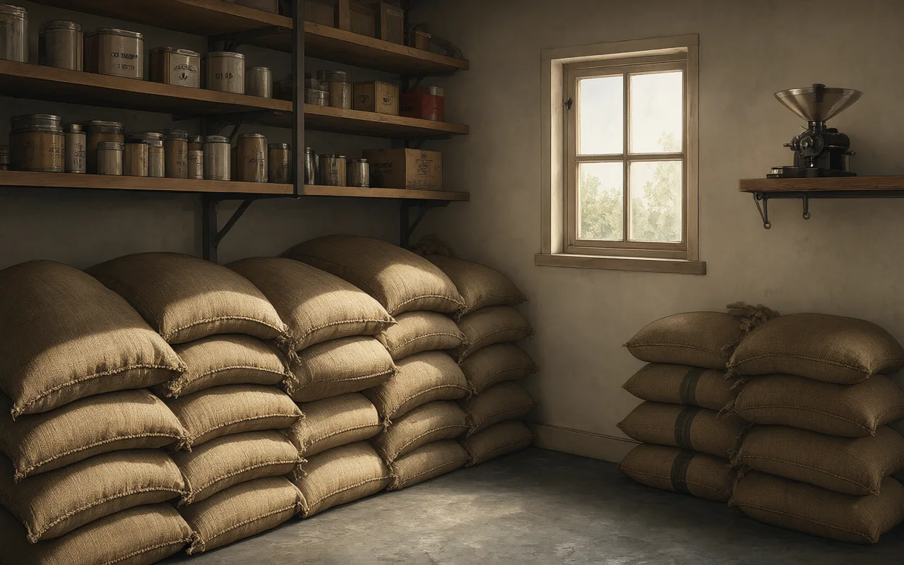
Original editorial illustration; it is not a documentary photograph of the place.
What it is: Le P’tit Café stands at 51 place Charles de Gaulle in Saint-Pierre-d’Albigny, and it is the first stop of the stage. The Savoie tourism listing describes it as a bar, brasserie and café-concert, a bistrot vivant with local produce, wines, coffee and beers, and flags it as a relais d’accueil touristique for the Coeur de Savoie area: a place with local documentation available all year. On a riding day that is more useful than it sounds.
Why it is here: Because it is the last valley-floor stop before the day turns into a chain of passes. The next point in this roadbook is the Col du Glandon, and behind it come the Croix de Fer, Saint-Jean-de-Maurienne, the Télégraphe, the Galibier and the Lautaret. All of that gets climbed on whatever you decided here: whether you eat properly or just take a coffee, whether you leave with water or without it, whether you set off at the pace you intend to be holding six hours later. This is the stop where the day gets organised, or does not.
Rough timing: As long as it takes to eat and drink something, and not one minute of sitting afterwards.
How to use the stop
Use it as the first stop it is: eat something solid if the day ahead is long, because the passes that follow have no terrace. Fill your water here, which is cheap and weighs little. And pick up documentation if you see local maps, because the venue itself works as a tourist-information point and in a valley that saves questions. Before you set off, decide where you next intend to check your own progress — that is, what your next real control is — and do not leave that decision for the first bend of the Glandon.
Solid food and water: the next comfortable chance comes late.
Local documentation, if it is there, beats an assumption.
The next point and your target time, settled before you pull away.
When to cut it short
If you left Voglans late, or the day is already running short, make it a quick coffee and move on. The venue's cultural life — exhibitions and live music on Friday evenings — is built for another moment, not for a riding morning. And if the place is full at peak time, do not wait for a table: the first stop of a mountain day is not worth losing over a seat.
Verifiable fact: The Savoie Mont Blanc listing, updated by the Office de tourisme Coeur de Savoie, gives this venue as a café-concert open daily from 07:00 to 21:00 on place Charles de Gaulle in Saint-Pierre-d’Albigny, with parking and a covered terrace among its facilities. What it means on the road: Treat that as a planning hint and confirm it when you arrive, because a café's hours change and this roadbook does not guarantee them. That it has its own parking and a covered terrace is useful information all the same: if the morning starts wet, you can get yourself ready under a roof before facing the first pass.
What it is: The road leaves the valley behind and starts folding back on itself. The slopes come closer, the air loses temperature and the bike finds that short rhythm of bends that needs no spectacle to command respect. The Col du Glandon does not welcome you with a big open plateau: it narrows the world until only rock, asphalt and the next line are left. You arrive from Voglans feeling that the mountain was still far away; here it is not.
Why it is here: On this day it appears after the first approach block and before the Croix de Fer. It is not an isolated name: it is the first piece in the chain that continues towards Saint-Jean-de-Maurienne, Télégraphe, Galibier and Lautaret. That is why it matters even if you decide not to stop. Here you understand that there is still a lot of mountain left and that it is worth saving attention and strength for what is coming.
How to use the stop
The approach deserves attention in itself. The bends, the changes of light and the closeness of the rock arrive in fragments, and there is no single viewpoint that sums up the pass. If you stop, look for a widening with visibility, leave the bike off the carriageway and spend a few minutes looking back: you will recognise the valley that has just closed. Do not chase one particular photograph; the strength of the Glandon is in what is built during the climb.
It is also a good place to notice the contrast with the Croix de Fer. They are neighbouring passes — barely two and a half km apart — and they do not produce the same feeling: one closes the valley and the other opens it.
When to cut it short
Passing by does not erase the place. The summit is brief and the road continues almost immediately towards another reading of the landscape: what remains is the impression of having crossed a threshold and the certainty that the great Alpine block is already under way.
On a loaded day, keeping your flow can be worth more than turning every sign into a stop. If you are short of time or the pass is busy, the Glandon does its job from the bike: it orders the story of the day — before there was approach, afterwards there is chained high mountain — and leaves you margin for the Galibier, which is where the day is really decided.
Verifiable fact: The pass reaches 1,922 metres and links the Maurienne and Eau d’Olle valleys. Near the top, the road lets you read the Aiguilles d’Arves and the massif that separates both sides. The reading of the landscape is yours: I live it as a gate, not as a medal, and the memory it leaves is in the change of scale, not in the sign. Decision: The decision is yours and it is worth taking it as you arrive: if there is room to stop without risk and the schedule still has margin, a few minutes are enough; if the pass is saturated or the light is already going, continue towards the Croix de Fer and keep the Glandon as lived from the road, which is where it best explains its character. To read further on the Col du Glandon there is this reference: Route des Grandes Alpes.
Col de la Croix de FerPass
Col de la Croix de Fer — where the day changes scale
What it is: You arrive from the Glandon with the mountain still stuck to your body. In barely a few km the landscape opens and the iron cross that gives its name to the Col de la Croix de Fer appears. It is not a solemn arrival: it is the moment you understand that the day is no longer about linking roads, but about crossing a range with time to read it.
Why it is here: The Croix de Fer sits on the crest of this day, before the descent to Saint-Jean-de-Maurienne and the start of the second great chain: Télégraphe, Galibier and Lautaret. That position gives it meaning. It is a possible pause between two worlds: behind you is the compact climb of the Glandon and ahead a day that still holds its highest names.
How to use the stop
The stop deserves to be brief and conscious. First the cross; then the horizon. If the day is clear, the Étendard and the Aiguilles d’Arves explain why this point feels wider than the Glandon. It is also worth looking at the road you have just come up: the closeness between the two passes is misleading, because each has a different personality.
There is no need to fill the time. A photograph, a few minutes of silence and a look back at what is still to come are enough for the pass to stay with you.
When to cut it short
The Croix de Fer also works without getting off the bike. The cross appears, the horizon changes and the road begins to deliver the descent towards the Maurienne; the scene is complete as you pass.
Carrying on can be the decision most faithful to the day when the schedule is tight: the Télégraphe and the Galibier will demand attention, and the greatness of this place does not depend on accumulating minutes in the car park. It is enough to know where you are and why, from here, the day enters another scale.
Verifiable fact: The pass is at 2,064 metres and lies about 2.5 km from the Glandon. It links the Arvan-Villards with the Oisans and lets you recognise the Pic de l’Étendard and its glacier, as well as the Aiguilles d’Arves. The present cross keeps the memory of the old name, Col d’Olle. These are facts that help you look; the rest appears when you stop seeing separate mountains and start reading a territory. Decision: If the pass is saturated or the mountain asks you to continue, cross it without stopping; the explanation can be recovered later, with the bike parked somewhere safe. The factual reference for the Col de la Croix de Fer can be consulted at Route des Grandes Alpes.
Saint-Jean-de-MaurienneTown
Saint-Jean-de-Maurienne — the valley between two acts
What it is: After the Glandon and the Croix de Fer, the descent drops you into a town that brings you back to everyday life at once. Traffic lights, facades, terraces and the permanent backdrop of the mountains: Saint-Jean-de-Maurienne is the valley's breath between two acts of high mountain. Here the epic comes down off its pedestal and fits into a coffee again.
Why it is here: Its place in the day is exact. It does not close the day; it separates the first chain from the Télégraphe–Galibier–Lautaret block. That is why it is not worth treating it as an added monumental visit: it serves to change pace, eat something and remember that the most famous stretch is still ahead. Leaving here in a hurry would waste the real function of this transition.
How to use the stop
If there is time, the best reading is not to run from one point to another. A short walk through the centre or a look at the silhouette of the cathedral changes the register of the day and gives depth to the route: the Alps are not only summits, they are also towns that have learned to live beneath them.
The name Opinel adds a concrete, recognisable story, tied to the trade and to the Maurienne, without turning the pause into a compulsory museum visit.
When to cut it short
From Saint-Jean the approach to the Télégraphe begins, the step that leads to Valloire and the Galibier. The road gains height again and the day recovers density: this is the moment to leave the urban noise behind, reset your head and enter the second act.
If you do not stop, the town keeps the same narrative function: it marks the bottom of the valley and the transition between two chains of passes. The change shows in the temperature, the traffic and the width of the horizon.
Verifiable fact: The town is the historic capital of the Maurienne and keeps the cathedral of Saint-Jean-Baptiste, the cloister and the memory of the Opinel knife, born in the valley and explained in the museum housed in the old family cutlery works. You do not need to walk it all to understand the place: it is enough to recognise that this basin has lived on passage, work and the mountain long before you arrived by bike. Decision: Here the decision is logistics: fuel, food and a real stop before the road narrows again. Adjust the length to the margin the Télégraphe and the Galibier need and fix your departure point before returning to the asphalt. The factual reference for Saint-Jean-de-Maurienne is Musée Opinel.
What it is: The Col du Télégraphe does not need to compete with the Galibier. Its character lies precisely in the opposite: it climbs through forest, with regular bends, and puts the rider into the state of mind that the great mountain demands. When the pass appears, the feeling is not of having arrived; it is of having received a clear warning of what starts on the other side.
Why it is here: On this day it comes after the Saint-Jean-de-Maurienne valley and before Valloire. It is the step up to the Galibier, not a secondary piece. From here you still have to descend slightly, cross the Valloirette valley and gain height again up to 2,642 metres. Understanding that sequence stops you spending all the emotion on the first sign and lets you read the day as a construction.
How to use the stop
The climb lets you find cadence after the traffic of the valley. The forest filters the light and the bends follow one another with a regularity that invites clean riding. If you stop, look beyond the sign: towards the void of the Maurienne and towards the presence of the fort, which turns a discreet pass into a balcony loaded with history.
It is a good place to think about what is coming without anticipating all of it: the Galibier is enjoyed more when you arrive with desire and not with anxiety.
When to cut it short
Continuing towards Valloire keeps the story intact. The Télégraphe is summited and left almost in the same gesture; that brevity is part of its personality. The important thing is to notice that the road has changed its intention.
As you descend towards Valloire the mountains open again and the great pass still does not show itself whole: the Télégraphe stays behind like a short sentence, and you have not yet seen the end.
Verifiable fact: The pass is at 1,570 metres. Very close by, on the cliff above Saint-Michel-de-Maurienne, the Fort du Télégraphe recalls the old Chappe signal tower and the militarisation of this Alpine corridor; the present fort was built between 1886 and 1890 to protect the square and the Galibier road. The history explains the name and also the strategic position you feel from the route. Decision: If you arrive with your rhythm already set and the Galibier is in good condition, continue towards Valloire; if you need to regroup or check how the day is going, the pass offers enough space for a short stop. The documented context of the Col du Télégraphe is available at Route des Grandes Alpes · Fort du Télégraphe.
Col du GalibierPass
Col du Galibier — when there is nothing left to distract you
What it is: After Valloire, the road takes its time to reveal its intention. It follows the valley, gains height and, little by little, leaves behind trees, houses and anything that might distract you. On the Col du Galibier only the line, the rock and a sky that seems closer are left. You arrive with several passes already in your body; that is why this height feels earned, not simply reached.
Why it is here: It is the great roof of the day and it appears after the Télégraphe. From the summit, the descent drops first to the Lautaret and then continues towards Briançon. That position concentrates the story of the day: everything before prepares this passage and everything after lets you absorb it. No description replaces the real state of the road or its seasonal opening.
How to use the stop
The mountain turns mineral near the old tunnel and the final bends lift the pass above the rest of the road. Wind and temperature can change the scene in minutes. If you stop, do it without unnecessary noise and with the bike off the carriageway: look first at the horizon and then at the ribbon of asphalt arriving from Valloire.
The memory of Henri Desgrange on the south side recalls the pass's relationship with cycling, but the emotion is born from the complete chain and from the rhythm you have found on the climb.
When to cut it short
Summiting does not close the pass. The descent towards the Lautaret is part of the same experience: altitude, exposure and views over the Écrins demand that you stay present. Passing without a long stop can be the right decision if wind, fog or crowding erase the enjoyment of the pass.
The memory does not depend on a photo next to the sign: it stays in the moment when the vegetation disappears and in the sight of an almost bare road.
Verifiable fact: The top reaches 2,642 metres. The historic route opened in 1886 and the Tour de France crossed it for the first time in 1911. From the top, when the atmosphere allows, you can recognise the Meije, the Écrins and their Glacier Carré; behind you are the mountains of Savoy and, sometimes, Mont Blanc. The value is not in reciting names, but in discovering the distance you have just crossed. Decision: Give yourself margin, but do not negotiate with the mountain: confirm opening and weather, and move the stop to the Lautaret if it is not safe to stop up there. The summit is crossed, not conquered. To read further on the Col du Galibier, the reference used is Route des Grandes Alpes.
What it is: The descent from the Galibier suddenly delivers a wider road and a horizon that breathes again. The Col du Lautaret does not have the tension of the previous summit; it has something else: perspective. Here you can look at the mountain head-on, recognise the Meije and understand that the day is starting to order everything lived before the descent to Briançon.
Why it is here: It is the last pass of the day and the point where the Galibier route meets the axis between the Romanche and the Guisane. After it comes the descent through Serre Chevalier to Briançon. That is why its role is not to compete with the great height, but to close the arc: it offers a friendlier place to stop, recover temperature and put a name to the landscape that from above you could only sense.
How to use the stop
If you stop, this is a good place to take off your helmet and let your eyes work. The Meije, the glaciers and the opening of the valley help you reconstruct the descent from the Galibier, and you feel the change between severe high mountain and a road that reconnects villages.
The pause can have a different tone: less celebration and more conversation with yourself about what the day has meant, before the arrival in Briançon scatters your attention.
When to cut it short
If you continue, the pass still does its job. The direction changes, the road follows the Guisane and the landscape accompanies a long descent where it is worth not relaxing too much. The tunnels and the traffic remind you that high mountain now shares space with a regular corridor.
What remains of the Lautaret is its clarity: after the vertigo, a balcony; after so many mythical names, a road that returns you to your accommodation without ceasing to be the Alps.
Verifiable fact: The Lautaret is at 2,057 metres, between the Arves and Écrins massifs, with an especially clear view over the glaciers of the Oisans. Unlike the Galibier, it usually stays open through the year except for snow or risk. Its accessibility does not make it banal: it is one of those passes where geography becomes visible and roads show why they exist. Decision: If there was no chance to stop calmly on the Galibier, this is the place. With margin and good temperature a few minutes are enough; with cold or fatigue, the priority is to recover before the final descent. The data that help interpret the Col du Lautaret come from Route des Grandes Alpes.
Day 3
Briançon - Saint-Gervais-les-Bains
260.17 km
Before you set off
Self-guided day of 260.17 km and 279 nominal minutes. You set the pace, the breaks and which suggestions are worth visiting. Use Calimoto as the master route and the Google Maps link as an orderly check; the stops are not compulsory. Check the road, the weather, fuel and daylight before you set off. This edition does not include accommodation or meals: arrange those services yourself and recalculate if any condition changes.
What it is: The road out of Briançon still carries the pulse of the city when it starts to gain height. At Montgenèvre there is no dramatic border: there are hotels, ski lifts, roundabouts and a valley that changes language almost without warning. That ordinariness is part of its charm, and the first pass of the day reminds you that the Alps have always been a place of passage, trade and coexistence. You set off with a cold engine and your head still in city traffic; here it is worth letting the rhythm settle before you ask anything of the day.
Why it is here: On this day it comes early, before the descent into the Susa valley and the run towards Mont-Cenis. It is not the great summit of the day; it is the hinge that sets you moving and swaps France for Italy over one stretch. Its position lets you ease into a long day that then links Mont-Cenis, Val-Cenis, Iseran and Cormet de Roselend before Saint-Gervais.
How to use the stop
If you stop, the mix is worth a look. French signs, Italian traffic, resort architecture and mountains that know nothing of customs. The scene is not aiming for Alpine silence; it tells you how a pass can become a place where people live.
It is also the first moment to listen to your own rhythm. The day has only just started, and any adjustment you make here — layers, fuel, the real state of the road — costs less than one improvised once you are already into the Iseran.
When to cut it short
The descent into Italy changes the orientation, the light and the kind of valley. Montgenèvre falls behind without any grand gesture, but it has done its job: you have crossed a border and the day is no longer a simple departure from Briançon.
Carrying on without stopping can even reinforce that sense of transit. The pass is experienced the way it has been for centuries: riding through it to reach the next territory.
Verifiable fact: The village sits on the pass itself, at around 1,860 metres, and its modern history is tied to skiing: in 1907 it hosted an international competition that consolidated its name as one of the pioneering resorts of France. But from the road another, older layer matters more: the evidence that this natural crossing had linked the Briançonnais with Piedmont for centuries before it became a tourist destination. Decision: On a wide, inhabited pass it is easy to find room, but not just anywhere will do: if you need to stop, look for a spot with clear visibility and leave the bike off the carriageway. If everything is in order, ride on; the day holds higher summits and it is not worth spending on the first sign the time you will need later. Supporting information for Col de Montgenèvre is at Montgenèvre · official history.
What it is: The climb leaves the Italian valley behind and, at the top, what appears is not a narrow pass but an immense plateau. The lake of Mont-Cenis spreads an almost unreal colour beneath peaks of more than three thousand metres. You enter an open scene, with room to breathe and to understand that Alpine borders are not always a line: sometimes they are an entire territory.
Why it is here: This day places it after Montgenèvre and before the Val-Cenis block. It is the great change of country and landscape before you take on the Iseran. The route descends into the Haute Maurienne, so the lake is not a decorative detour: it runs with the real corridor and sets up a sequence in which military history, water and high mountain mix.
How to use the stop
If you stop, your eyes should go first to the whole: water, pastures, forts and peaks. Picking out a single object impoverishes the scene. The lake changes with the light and with its level; early in the season you may even see traces of old Italian works appear.
It is a pause that lets you open up after the concentration of the valley. A photograph makes sense, but more so does recognising that you are riding through a corridor that has moved people for centuries.
When to cut it short
Carrying on beside the lake keeps the whole experience. The road follows the water and offers the scene in motion, with the forts appearing at different distances. There is no need to hunt down every viewpoint.
The descent to Val-Cenis gives depth back to the landscape and puts you in front of the next decision of the day. Mont-Cenis stays as an expansion: the moment the border stopped being a checkpoint and became a horizon.
Verifiable fact: The plateau sits at around 2,000 metres and was an essential route between France and Italy from the Middle Ages, travelled by traders, pilgrims, armies and rulers. Today's lake is a reservoir built between 1962 and 1968. The 19th-century forts and the bunkers recall the old border tension; the territory passed definitively to France after the Second World War. Decision: The plateau is wide, but not all of it is a good place to stop: choose a point that does not scatter you or force you back onto the carriageway in a hurry. If the wind, the traffic or the clock are against you, read it from the bike and carry on to Val-Cenis; the lake does not need a long stop to impose itself, and the Iseran is still ahead. To widen the reading of Mont-Cenis, these references remain: Haute Maurienne Vanoise.
Col de la Madeleine (Val-Cenis)Pass
Col de la Madeleine: the small pass of the big day
What it is: After the breadth of Mont-Cenis, the Col de la Madeleine de Val-Cenis shifts the focus. It is not the famous Madeleine of the Tour and does not pretend to be. It is a fold of the Haute Maurienne, close to Bessans, where the road comes back near meadows, roofs and slopes. On a day full of giants, its value lies in reminding you that mountains are also built from transitions.
Why it is here: It appears between Mont-Cenis and the approach to the Iseran. That position makes it an intimate hinge: you have already crossed the border, but you have not yet entered the highest summit of the day. The pass helps to order the valley and to show how the route is leaving inhabited places behind again to seek the great corridor of Bonneval and Val d’Isère.
How to use the stop
If you take a break, look at what is close: the shape of the valley, the houses of Bessans, the pasture slopes and the road that settles among them. Not every Alpine scene needs a horizon of glaciers.
The pass also lets you notice the repeated names of the mountains and how a route only makes sense when each point is placed in its own territory. That precision gives more soul than any list of figures.
When to cut it short
La Madeleine is understood very well from the bike. It is a gentle change of orientation and scale before the valley tightens again towards Bonneval-sur-Arc. Stopping out of duty would break precisely its character as a transition.
If you carry on, you keep the continuity and save energy for the Iseran. The place stays in memory as a visual pause: less monumental, more human, necessary so that the great passes do not become a succession without shades.
Verifiable fact: The name can mislead, because the French Alps keep several passes called Madeleine. This place belongs to the Val-Cenis sector, next to Bessans, and not to the 1,993-metre col that links Tarentaise and Maurienne. Being precise about the place matters: here it is not about collecting famous names, but about reading correctly the road you actually ride on this day. Decision: There is no obligation to stop here: it is a summit to read while you ride. If you are short of time, simply recognise it as you pass and keep margin for the Iseran; if the day is running comfortably and you find a safe space, a brief photograph makes sense. The priority is to identify the place properly, not to turn it into an automatic stop. The factual reference for Col de la Madeleine can be checked at Haute Maurienne Vanoise.
What it is: Bonneval lies below and the road begins to shed everything everyday. The curves gain height between bare slopes until the Col de l’Iseran appears at 2,770 metres, cold even in summer. You do not arrive at just a summit: you arrive at the point where a line of asphalt seems to defy the logic of the valleys it connects.
Why it is here: On this day it is the great roof between the Haute Maurienne and Val d’Isère. It comes after Mont-Cenis and Bessans, and before the Cormet de Roselend. Its role is central: it marks the change from the Arc basin to the Tarentaise and concentrates the most exposed part of the day. The road usually opens from June to October depending on the snow; its real condition always overrides any story.
How to use the stop
If you stop, the first sensation is usually the temperature. Then comes the horizon: glaciers of the Maurienne, slopes of the Tarentaise and a road that vanishes on both sides. The chapel helps you measure the size of the landscape.
The sign attracts everyone, but the deepest memory is a few steps further on, looking at the line you have ridden. Getting here after so many km gives the scene meaning without turning it into a conquest.
When to cut it short
The side towards Val d’Isère is no minor epilogue. The altitude, the wind and the changes of surface demand that you keep your attention. If the summit is crowded or covered in cloud, carrying on protects your rhythm without making it less important.
The pass stays with you during the descent: the vegetation returns little by little, the first buildings appear and you understand how much height you have just lost. That transformation is an essential part of the experience.
Verifiable fact: The pass road opened in 1937 and today it is the highest paved pass in the Alps. Around it spreads the Vanoise National Park, with glaciers, alpages and peaks that explain the severity of the place. The small chapel of Notre-Dame-de-Toute-Prudence adds a human scale to a summit where almost everything looks mineral. Decision: Before you climb, decide with data: confirm that it is open and check the weather, and accept that the stop may be short or moved to a lower summit. No photograph justifies staying exposed to cold, fog, wind or congestion, and on a bike retreating in time is also a criterion. If something does not fit, go back down and leave the Iseran for another occasion. The factual reference for Col de l’Iseran is Val d’Isère · Col de l’Iseran.
Cormet de RoselendPass
Cormet de Roselend: the mountain turns green again
What it is: After the Iseran, the day might seem already told. Then the Beaufortain arrives and the mountain changes language. At the Cormet de Roselend the pastures, the water and a road that draws gentler curves between open slopes come back. It is no minor ending: it is proof that the Alps can change character several times in the same day.
Why it is here: It is the last great pass before Saint-Gervais-les-Bains. The route reaches it after crossing the Tarentaise and continues towards the Roselend reservoir and Beaufort. Its job is to close the chain without repeating the severity of the Iseran. You arrive with hours of mountain behind you, so here the beauty has to live with riding that is still precise.
How to use the stop
If you stop, it is worth looking for the relationship between road, pastures and water, not just the summit sign. The lake appears and disappears depending on where you are, and that sequence follows the story of the pass better than a single view.
The pause can have a closing tone: there is still the arrival to come, but the great Alpine block of the day is already behind you. It is a good place to acknowledge tiredness and satisfaction too.
When to cut it short
The descent is beautiful and can invite you to relax too much. The curves, the local traffic and accumulated fatigue demand that you keep it clean down to the valley. Carrying on without a long stop can preserve exactly the energy you will need at the end.
Cormet de Roselend then stays as a film in motion: meadows, water, cabins and the lower light of the afternoon. A farewell to the high mountains that needs no ceremony.
Verifiable fact: The cormet reaches 1,968 metres and links Bourg-Saint-Maurice with the Beaufortain. Very close by, the Roselend lake occupies an old area of alpages and mirrors the peaks that surround the massif. The word "cormet" belongs to the local vocabulary of the passes. The landscape combines hydroelectric infrastructure and livestock tradition, a mix that explains much of these valleys. Decision: Decide the stop by the clock and by how your body feels, not by the fame of the pass. If you stop, set yourself a clear limit before you get off the bike; if you carry on, use the descent to keep your concentration and mark a checkpoint on the map before Saint-Gervais-les-Bains, where you can check fuel and daylight. The documented context for Cormet de Roselend is available at Beaufortain · Cormet de Roselend.
Day 4
Saint-Gervais-les-Bains - Hasliberg
271.51 km
Before you set off
Self-guided day of 271.51 km and 303 nominal minutes. You set the pace, the breaks and which suggestions are worth visiting. Use Calimoto as the master route and the Google Maps link as an orderly check; the stops are not compulsory. Check the road, the weather, fuel and daylight before you set off. This edition does not include accommodation or meals: arrange those services yourself and recalculate if any condition changes.
TrümmelbachfälleHeritage
Trümmelbachfälle: listening to the inside of the mountain
What it is: In Lauterbrunnen the walls look too vertical for the valley. Then the water stops falling on the outside and enters the rock. At Trümmelbachfälle you leave the bike parked to listen to something the road cannot tell: the roar of ten glacier waterfalls cutting their way inside the mountain.
Why it is here: The visit comes at the end of a long day that has already crossed Montets, Forclaz, Croix and Pillon. It is not a brief signpost stop. It needs opening hours, a ticket and time on foot; that is why including it depends on the real margin. The detour inside the Lauterbrunnen valley makes sense if it lets you live the place without turning the arrival at Hasliberg into a race.
How to use the stop
The sound arrives before the sight. Inside, the damp, the polished rock and the lit water produce a scale unlike any pass. Walk without rushing, in firm footwear, and let each chamber reveal another shape of the torrent.
It is not an attraction added at random. After so many passes, going into the mountain lets you understand where the rivers are born and why these valleys have such powerful walls.
When to cut it short
Giving up the visit does not invalidate Lauterbrunnen. The valley, its walls and the outside waterfalls still accompany the route. Forcing your way in near closing time or with a tired body would turn an extraordinary experience into an obligation.
If you carry on, this reading serves to name what is left pending and to understand the water you see from the road. You decide: the day does not promise open doors or demand that you sacrifice the arrival to tick off a place.
Verifiable fact: The Trümmelbach drains the glacier walls of the Eiger, Mönch and Jungfrau. At times of heavy melt it can move up to 20,000 litres per second. The ten waterfalls are accessible through protected paths, stairs and a tunnel lift. The site usually opens from spring to early November depending on conditions; the full experience takes between one and two hours. Decision: Before you turn off, check opening hours, access and the time you have, and decide with the clock in front of you. The visit only makes sense if you can park, go in and come out without turning the arrival at Hasliberg into a race; if not, follow the route and keep Trümmelbach as context for the valley, not as an outstanding debt. The factual reference for Trümmelbachfälle can be checked at Trümmelbachfälle official.
Day 5
Hasliberg - Rankweil
268.28 km
Before you set off
Self-guided day of 268.28 km and 249 nominal minutes. You decide the pace, the breaks and which suggestions are worth visiting. Use Calimoto as the master track and the Google Maps link as an ordered check; the stops are not compulsory. Check the road, the weather, fuel and daylight before setting off. This edition does not include accommodation or meals: arrange those services yourself and recalculate if a condition changes.
Hotel TiefenbachCoffee stop
Hotel Tiefenbach: the house in Realp where the day chooses between the pass and the train
Original editorial illustration; it is not a documentary photograph of the place.
What it is: Hotel Tiefenbach is the hotel the municipality of Realp publishes in its own accommodation directory: Furkastrasse 140, 6491 Realp, in the canton of Uri, run by Madeleine and Hansruedi Tresch and with a website of its own. It stands on the floor of the Urseren valley, at the Uri head of the Furka road, exactly where the way stops being a valley and starts being a pass. It is not a service area: it is a village house with rooms and a kitchen, and that difference decides how you use the stop.
Why it is here: Because Realp is not just any point of the day: it is where the Furka car shuttle loads, the train that carries vehicles through the base tunnel. That turns this stop into the place where the day can change shape. If the pass road is open, this is where you finish deciding how much margin you give it. If it is not, the alternative that keeps the trip standing is waiting right here. On a 268.28 km day between Hasliberg and Rankweil, with the drop into the Reuss valley, the Klausen and the final link still ahead, that is the most expensive decision of the morning and the cheapest one to settle: it takes twenty minutes, next to the bike, not halfway up a ramp with a fogged visor.
Rough timing: a short, warm stop: coffee, a toilet stop, layers and one decision. It is not a meal and not a visit to the Urseren valley.
How to use the stop
Arrive, park and spend the first minutes on what cannot wait. Check the state of the Furka road on whatever source you have, because on a pass at this height the difference between yesterday and today is the difference between riding up and loading onto the train. If you are crossing on the car shuttle, confirm times and whether you need a reservation, and do it here with the engine off, not in the boarding queue with the bike running. Then deal with your body: in Realp the temperature and the wind are nothing like the valley you have come from, and a hot coffee is the difference between reaching the Klausen in one piece and reaching it shivering. Before you pull away, leave the next point confirmed and the time you want to be in Gurtnellen settled.
The state of the Furka confirmed, not assumed.
Car shuttle: times and reservation checked if the pass is not passable.
Layers, dry gloves and fuel checked before you carry on.
When to cut it short
If the day has started late or the pass is compromised, this stop shrinks to the minimum: a coffee standing up, a road check and back to the bike. The Urseren valley, Andermatt and the Schöllenen descent deserve a quiet day of their own, and this is not it: there are 268.28 km with the Klausen waiting at the end. What you should not do is sit down for a meal here without first deciding which part of the day you are going to cut afterwards, because the time you spend in Realp is paid for further down, in the Reuss valley.
Verifiable fact: The municipality of Realp includes Hotel Tiefenbach, Furkastrasse 140, 6491 Realp, in its official accommodation directory, with Madeleine and Hansruedi Tresch as the hosts and hotel-tiefenbach.ch as the establishment's website. What it means on the road: in a mountain village the places to eat and sleep are exactly the ones the municipality itself publishes, no more, and that is why you confirm this stop before setting off instead of assuming it on arrival.
Gasthaus im Feld: the one real meal of the day, on the floor of the Reuss valley
Original editorial illustration; it is not a documentary photograph of the place.
What it is: Gasthaus im Feld is a fifth-generation inn in Gurtnellen Dorf, in the upper Reuss valley in the canton of Uri, at around 1,000 metres and on the Gotthard corridor. Its address is Dorfstrasse 56, CH-6482 Gurtnellen Dorf. It is not a service area: it is a house with its own kitchen and traditional Uri cooking, and that difference is exactly what makes it a stop rather than a lay-by.
Why it is here: It is the second stop of a 268.28 km day between Hasliberg and Rankweil, and it arrives once the hardest part of the opening passes is behind you, with the Klausen and the link to the Rhine valley still to come. You do not come here for a quick coffee: you come to sit down and eat and to get your body back for the second half. That makes it the longest stop of the day and also the most fragile, because it depends on a timetable you do not control: the house publishes service from Wednesday to Saturday, kitchen 11.30–14.00 and 18.00–21.00, closed Sunday and Monday, and asks for a reservation for dinner. If your day falls on a Sunday or a Monday, this stop does not exist as written and you have to replace it before you set off.
Rough timing: a sit-down meal, not a coffee. The day carries 249 nominal minutes for 268.28 km, so this is the point where the clock stops being yours for a while; decide now how much you grant it and stick to it when you leave the table.
How to use the stop
Confirm the day of the week and the published hours before you count on this stop, and ring ahead if you will arrive close to the end of kitchen service. If you plan to eat dinner here, book. Gurtnellen is a valley village on the Gotthard corridor and the street through it is the village: there is no reserved motorcycle parking, so leave the bikes in a legal space without taking the room the residents need and without blocking the through traffic that never really stops.
If the day is a Sunday or a Monday, write this stop off before you leave and pick a substitute on the route.
If you eat here, set your departure time as you sit down, not when the pudding arrives.
It is the last comfortable point before the Klausen: check fuel, layers and mood before you pull away.
When to cut it short
Gasthaus im Feld is the stop that falls away when the morning has run long, when the day is a Sunday or a Monday, or when you want to reach Rankweil in daylight. In those cases you do not have to give up everything: a coffee and something light does the recovery job without spending the hour you need for the Klausen and the final link. What you should not do is sit down to a full meal without first deciding what you are going to cut afterwards.
Verifiable fact: Gasthaus im Feld presents itself as a fifth-generation family business — "147 Jahre Gastfreundschaft im Feld" — with Beat Walker in the kitchen, four double rooms and traditional Uri cooking; the municipality of Gurtnellen lists it in its own directory of places to stay and eat, and it is the municipal reference that supports the fact that the house is still open and still trading. What it means on the road: in a transit valley like the Reuss there is a proper house kitchen worth an hour of your day, provided the day of the week agrees.
Hotel Café Seeblick: the last viewpoint of the day, before the drop to the Rhine valley
Original editorial illustration; it is not a documentary photograph of the place.
What it is: Hotel Café Seeblick is a café with rooms in Filzbach, on the Kerenzerberg — the balcony that looks over the Walensee from the municipality of Glarus Nord, between the water and the Churfirsten range. Its published address is Kerenzerbergstrasse 8, 8757 Filzbach. In the region's official tourism register it appears as "Hotel Cafe Seeblick", without an accent on "Cafe"; the name of the stop and the name of the establishment match, so what you read on the sign is what you are looking for.
Why it is here: It is the third stop of a 268.28 km day between Hasliberg and Rankweil, and it sits in the second half, once the Klausen is behind you and the final link to the Rhine valley is still to come. Its job is different from the other stops of the day: it is not a meal and not a refuel, it is a height from which you can see the riding you have done and the riding that is left. From the Kerenzerberg the Walensee shows itself whole, and that view is the day's last chance to look back before you drop into the industrial valley floor. It is also the last point where you can still change the end of the day in daylight: after it, the decision is made on the move.
Rough timing: about 25 minutes for a coffee, a toilet stop and putting your plan back in order. That is an editorial reference, not a booking: the view does not close, but the kitchen does.
How to use the stop
Confirm that it is open before you count on it. The regional tourism register publishes the restaurant as Saturday and Sunday 10.00–22.00 and closed Monday to Friday, and the accommodation as every day 08.00–18.00; the house's own website was not answering when checked on 27 September 2026. In other words: on a weekday you may find the terrace and the viewpoint available and the kitchen shut. Ring ahead if you are coming to eat. The café sits on the Kerenzerberg road with the lake below and the road itself as the only approach: there is no reserved parking, so leave the bike off the carriageway where the signs allow, because this is a mountain road with traffic and not a village square.
Check the day of the week: the restaurant is advertised for Saturday and Sunday only.
If time is tight, keep the viewpoint and give up the service; the landscape does not depend on opening hours.
Before dropping to the valley, check layers and light: up here the weather turns before it turns in Rankweil.
When to cut it short
This stop gets cut when you are running late, when fog or rain takes the view — which is its only reason to exist — or when it is a weekday and you only wanted to eat. In the first case, a five-minute halt at the viewpoint does the resting job at no cost; in the second there is nothing to rescue and the sensible move is to carry on towards the Rhine valley. Do not turn a suggestion into an obligation: if the day has nothing left in it, this is the stop that forgives being skipped.
Verifiable fact: Filzbach belongs to the municipality of Glarus Nord and the Kerenzerberg is the height that separates the Walensee from the Churfirsten; the regional tourism register lists the Seeblick Walensee restaurant as Saturday and Sunday 10.00–22.00 and closed Monday to Friday, and the accommodation as every day 08.00–18.00; the house's own website was not answering on 27 September 2026. What it means on the road: the viewpoint is always there, the coffee is not — on a weekday this stop is landscape, not service.
Restaurant Rüthihof: the last Swiss table of the day, before the country and the currency change
Original editorial illustration; it is not a documentary photograph of the place.
What it is: Rüthihof is a restaurant in Rüthi, a municipality in the St. Gallen Rhine valley in Switzerland, and on this day it does one very specific job: it is the last stop of the day on Swiss soil. Rüthi sits at the foot of the Hoher Kasten, with the floor of the municipality at around 424 metres above sea level and its highest point at 1,386 metres on Alp Kamm/Dürrenegg, according to the figures the municipality itself publishes. It is not a viewpoint and not a monumental village: it is a working place of around 2,600 people, and that is exactly why it works as a stop rather than as an outing.
Why it is here: Because on a 268.28 km day between Hasliberg and Rankweil this is the fourth and last stop, and it arrives when all the day has left is to close properly. By now the morning passes and the descent into the valley are behind you; what is left is the final link and the border. Rüthihof is the place where you still decide calmly: whether you eat something sitting down or hold out until Rankweil, whether you refuel here or trust the next station, whether you keep Swiss currency in your pocket for the rest of the trip or spend it now. They are small decisions, but they are the last ones this day lets you take at no cost.
Rough timing: a service stop, not a meal of the stage: something light, water and the last regroup before the final link.
How to use the stop
Arrive, park and settle in one movement what you will no longer be able to settle afterwards. Confirm the opening hours and whether the place is actually open before you count on the service: out of season or out of hours, a valley restaurant is a closed frontage, and it is better to know that before you turn off. There is no reserved motorcycle parking; leave the bike where the signs allow, grouped and without blocking entrances, and check that you are not in the way of people coming in or out. Use the stop to drink proper water and to look at the clock: if the plan is to eat here, set your departure time before you sit down, because on this stop the clock is the only thing you can lose without getting it back.
Opening hours and availability confirmed before you count on the service.
Bikes grouped where the signs allow, without blocking entrances.
Fuel, water and departure time decided here, not afterwards.
When to cut it short
If the day has run long, if you ate late or if you would rather reach Rankweil in daylight, Rüthihof shrinks to a drink and a check. Rüthi offers nothing that demands you stay: the Hoher Kasten, the Alp Kamm ridge and the views over the Rhine valley ask for a day of their own, with a cable car and hours ahead of you, and this stage does not have them. What you should not do is turn the stop into a long meal exactly on the stretch where the day has no cushion left: here the margin you spend comes straight off your arrival time.
Verifiable fact: The municipality of Rüthi publishes its own figures: around 2,600 inhabitants, 9.3 square kilometres of municipal area, the lowest point at 424 metres at Tänneli/Aeuli and the highest at 1,386 metres on Alp Kamm/Dürrenegg, with the village sitting at the foot of the Hoher Kasten. What it means on the road: the last stop of the day is at the level of the Rhine valley floor, not on a pass, and that detail changes what your body asks for: after a day of high passes the problem here is not cold or fog, it is the clock and accumulated tiredness.
Self-guided day of 358.89 km and 290 nominal minutes. You decide the pace, the breaks and which suggestions are worth visiting. Use Calimoto as the master track and the Google Maps link as an ordered check; the stops are not compulsory. Check the road, the weather, fuel and daylight before setting off. This edition does not include accommodation or meals: arrange those services yourself and recalculate if a condition changes.
Alpenrast TyrolCoffee stop
Alpenrast Tyrol: the first break of the longest day, with its own exit and no vignette
Original editorial illustration; it is not a documentary photograph of the place.
What it is: Alpenrast Tyrol is a service and hospitality complex in Mils bei Imst, in the Austrian Tyrol, with its address at An der Au 1, 6493 Mils bei Imst and a phone line of its own. Several kitchens and spaces share one roof — the Tyroler Stuben, the Marktrestaurant, the Pizzeria Via Claudia and the Tirolino cafeteria — plus a Dorfladen, a village shop, and rooms. It sits directly on the Inntalautobahn A12, between Imst and Landeck, and it has its own exit into the complex.
Why it is here: Because it is the first stop of the longest stage of the trip: 358.89 km and 290 nominal minutes between Rankweil and the Grossglockner, and this point comes up at around the 100 km mark. By then you already have the first hours of road behind you and you still have the Zillertal, the alpine stretch and the final climb to the Grossglockner ahead, so what you need here is not an experience, it is efficiency. And one detail makes this stop different from any other in the day: the house itself states that it can be reached from both directions and without a vignette from the B171 federal road. In other words, this is the first real break of the day that does not force you to buy the motorway sticker or commit to the A12 in order to get to it.
Rough timing: twenty minutes on the clock: coffee, a toilet stop, water and a quick check. The complex is big and handles a lot of people at once, and that is exactly what makes it dangerous for your schedule.
How to use the stop
Come in through the dedicated exit and park where the signs allow, grouping the bikes without taking more space than you need. Decide what you are going to do before you get off, because the offer branches here: if you want something quick, the cafeteria and the shop will do it; if you want to sit down for a meal, the Marktrestaurant or the pizzeria will cost you far more than twenty minutes. Buy water in the Dorfladen and fill up now, before the day enters the narrow valley section. Check fuel and the target time for the next point, Schlitterer See: if you are running late, this is the place where you can still recover without giving anything up, and if you are on time, this is the place where you can lose it without noticing.
Vignette-free access from the B171 if you do not carry the motorway sticker.
Pick one food space and stick to it: four options are a clock trap.
Water and fuel sorted here, with the alpine part still ahead.
When to cut it short
If the morning has run long or the Grossglockner sky looks heavy, Alpenrast shrinks to a coffee standing up in the cafeteria and a bottle of water from the shop. The complex offers nothing that demands you stay: there is no old town, no viewpoint, and nothing of Imst or the Inn valley to see from the terrace. It is infrastructure, and infrastructure is meant to be used: the sooner you are back on the bike, the more margin you will have on the stretch where the day is really decided, which is not this one.
Verifiable fact: The official Alpenrast Tyrol website places the establishment directly on the Inntalautobahn A12 between Imst and Landeck, with its own exit, and states that it can be reached from both directions and without a vignette from the B171 federal road; the company is listed as Alpenrast Tyrol GmbH, An der Au 1, 6493 Mils bei Imst. What it means on the road: on the longest day of the trip you have a complete, fast stop that does not force you onto the toll motorway to reach it, and that turns this point into the first pace decision of a 358.89 kilometre day.
Schlitterer See Café / Restaurant: the last valley stop before the Zillertal turns alpine
Original editorial illustration; it is not a documentary photograph of the place.
What it is: Café / Restaurant Schlitterer See is the food and drink business at the bathing lake in Schlitters, in the Tyrolean Zillertal, and the municipality publishes it among its own facilities: Seestraße 3, 6262 Schlitters. It sits right beside the Badesee, the family bathing lake, with a large sun terrace, and it shares the grounds with a sunbathing lawn, a swimming jetty, a beach volleyball court and an adventure playground with tree houses, slides and giant swings. The municipality adds one practical detail for anyone arriving on two wheels: the site has ample parking. The site is a bathing lake in summer and the traffic is families on foot, so there is no reserved motorcycle parking: keep the bikes together in the spaces the signs mark and leave both the restaurant entrance and the way down to the water clear.
Why it is here: Because it comes up at around the 206 km mark of a 358.89 km, 290 minute day between Rankweil and the Grossglockner, just before the stage enters its most alpine part. That is its exact value: it is the last valley stop, the last one with valley services and with a comfortable place to pause without watching the altitude or a pass's opening calendar. It is also the stop where you should be clear about what is lake and what is café: the Badesee is a municipal bathing area with a tariff published by the municipality itself — an adult day ticket and a reduced rate from 16.00 — and the restaurant is a separate business with its own contact details under the same name on the door. If all you want is a coffee, do not confuse the two and do not assume that entry to the grounds is free.
Rough timing: twenty minutes for coffee and a check. A sun terrace with the lake in front of it is exactly the kind of place where those twenty minutes become an hour without you deciding it.
How to use the stop
Come in, park and deal first with what the day needs from you: water, a toilet stop, a fuel check and the target time for the next point. Confirm the published opening hours for the actual date of your trip before you count on the service, because a valley bathing lake has a season and a seasonal restaurant has closed doors outside it. If you are going to eat something, do it here and not further up: after this stop the services thin out and the alpine stretch does not forgive an improvised pause. And if the afternoon is pressing, this is the place where you can let the terrace do its work for twenty minutes and get back on the bike with a clear head for what is left.
Opening hours and season confirmed before you count on the service.
Bikes grouped where the signs allow, without cutting off the way to the lake.
Water, fuel and departure time settled before the alpine stretch.
When to cut it short
If the day is tight or the alpine stretch looks cloudy, this stop shrinks to a quick coffee and a bottle of water. The lake, the adventure playground and the lawn are a half-day family plan, and that plan is not this day: there are 358.89 km with the Grossglockner at the end, and whatever time you give the lake you take from your arrival. What you should not do is sit down for a meal without first deciding how long the meal lasts, because on this stop the difference between twenty minutes and an hour is not set by the service: you set it when you sit down.
Verifiable fact: The municipality of Schlitters describes the Schlitterer See as a family bathing lake directly on the Zillertal cycle path, with a large sun terrace, a covered play area, a beach volleyball court, a jetty, a sunbathing lawn and ample parking, and it publishes the lake's admission prices separately; the Café / Restaurant is listed at Seestraße 3, 6262 Schlitters with its own contact details. What it means on the road: this stop is a valley leisure complex, not a mountain refuge, and its usefulness to you lies in the parking and the kitchen, not in the water.
Hankes Café in Krimml: the last stop before the day is settled on the Grossglockner
Original editorial illustration; it is not a documentary photograph of the place.
What it is: Hankes Café is a café-restaurant in Krimml-Hochkrimml, in the Salzburg Pinzgau, and it appears in the official food and drink directory of the Zillertal Arena, the region's tourist board. It stands in the village that gives its name to the Krimmler Wasserfälle, the Krimml waterfalls, and that is the fact that matters: the stop is a step away from the most visited natural attraction in the area and, for exactly that reason, its job on this day is the opposite one — to be the last cheap pause before the final run to the Grossglockner.
Why it is here: Because it is the third and last stop of the longest stage of the trip — 358.89 km and 290 minutes between Rankweil and the Grossglockner — and it arrives when all the day has left is the approach and the final climb. Two accounts get settled here that cannot be settled further up. The first is the waterfalls: the Krimmler Wasserfälle drop in three stages with a total fall of 380 metres, carry an average of 5.6 cubic metres per second, sit inside the Hohe Tauern National Park and receive around 400,000 visitors a year, which puts them among the ten most visited attractions in Austria. Their trail opens from mid-April to the end of October and access is subject to a fee. In other words: they are not a coffee break, they are a visit with a ticket, a season and hours of walking, and today the correct answer is no. The second account is yours: layers, fuel and arrival time.
Rough timing: a coffee and twenty minutes. If the answer on the waterfalls is yes, this stops being a pause and becomes half a day the day does not have.
How to use the stop
Arrive, park where the signs allow and confirm that the place is actually open for the date of your trip before you count on the service: out of season, in a mountain village the food trade closes and the frontage does not warn you in advance. Settle the waterfalls question now and out loud, not as you ride past the entrance: if you are not going up the trail, say so and carry on; if you are going up, then this day changes shape and you want to know that before you order the coffee, not after. Use the stop for the road detail as well: if your line to this point has climbed the Gerlos Alpenstraße, it is a toll road open all year, and the operator applies a discount on its day ticket if you show a Grossglockner day ticket for the same day. Checking that costs one question at the barrier and cannot be recovered afterwards.
Opening of the establishment confirmed for the actual date of the trip.
The waterfalls decision taken here, before the entrance and not after.
Layers, fuel and target time for the Grossglockner set before you pull away.
When to cut it short
If the day is tight, if you set off late or if the Grossglockner is under cloud, this stop stays at a coffee and a check. The waterfalls deserve a day of their own, with time for the trail and the walkways, and that day is not this one: there are 358.89 km and the final climb still to come. What you should not do is decide halfway: neither sit down for a meal here with the day still open, nor ride past the waterfalls without having consciously decided to leave them for another trip. A renunciation holds when it is a decision, not when it is a surprise.
Verifiable fact: The official information for the Krimmler Wasserfälle, run by the Warnsdorf-Krimml section of the Austrian Alpine Club, describes three fall stages with a total drop of 380 metres, an average flow of 5.6 cubic metres per second, around 400,000 visitors a year and a setting inside the Hohe Tauern National Park, with the waterfall trail open from mid-April to the end of October and access subject to a fee. What it means on the road: the most powerful natural attraction of the day is within sight of this stop and the correct answer today is not to see it, so this entry exists to make that renunciation a decision rather than an oversight.
Self-guided day of 265.54 km and 255 nominal minutes. You decide the pace, the pauses and which suggestions are worth visiting. Use Calimoto as the master route and the Google Maps link as an ordered check; the stops are not compulsory. Check the road, the weather, fuel and daylight before setting off. This edition does not include accommodation or meals: arrange those services yourself and recalculate if a condition changes.
Café Central LienzCoffee stop
Lienz: fuel, layers and timing in the first town after the Grossglockner
Original editorial illustration; it is not a documentary photograph of the place.
What it is: Lienz is the main town of East Tyrol, set between the Drau and the Isel, with its Hauptplatz and the Liebburg, and on this day it works as a logistics stop: it is the first town that appears as you come down from the Grossglockner. It is not a destination in itself; it is where you sort out fuel, layers and time before the long transfer into the Dolomites. This stop was called "Café Central" in an earlier version of this roadbook and the name is kept here only so you recognise it: there is no verified venue trading under that sign in Lienz, so do not count on a specific address and settle the stop around the Hauptplatz with whatever you find open.
Why it is here: It is the first stop of a 265.54 km day that runs from the Grossglockner to Merano, and Lienz is the first town that appears after the pass. The Grossglockner Hochalpenstrasse is 48 km and 36 bends long, crowns at the Edelweißspitze at 2,571 metres and charges at both ends, Ferleiten/Fusch and Heiligenblut. Coming down from it, Lienz marks the change in the day's character: the high mountain road is over and the transfer towards the Dolomites begins, with Arabba and Pinei still ahead. Three decisions get taken here at once: fuel, layers and time. And one condition governs all three: the Hochalpenstrasse is seasonal, open from early May to early November — in 2026 it opened on 25 April — and from 1 September it closes at 19.30. If you ride outside the season, this day does not exist as written.
Rough timing: coffee, a toilet stop and fuel, nothing more. The day carries 255 nominal minutes for 265.54 km: whatever you spend here comes out of the margin you need to enter the Dolomites in daylight.
How to use the stop
Ride into Lienz and settle the stop around the Hauptplatz, without hunting for a particular sign that may not exist. Do not look for a reserved spot: Lienz is a working town and the useful thing is to leave the bike in the first legal space you find on the way in, off the pavement and clear of the shop entrances. That is five minutes spent at the stop instead of fifteen circling the centre. Before you pull away, refuel: the next part of the day is mountain and bends, and you do not want to be negotiating fuel halfway up a pass.
Treat the name of the venue as something to confirm on the spot; do not build your morning around a sign you have not checked.
Refuel here and re-check your layers: Lienz has one kind of weather and the passes ahead have another.
If you set off intending to cross the Grossglockner again, check its closing time before you sit down.
When to cut it short
Lienz is the stop that shrinks to a refuel when the Grossglockner has cost more than planned, when it is raining, or when you want to reach Arabba and Pinei in daylight. Nothing essential is lost by cutting it: its job is logistical, not scenic, and a valley town can be visited on another trip. What you should not do is stretch it out of habit and then discover that the transfer to the Dolomites has been ridden in the dark.
Verifiable fact: Lienz is the main town of East Tyrol and stands between the Drau and the Isel; the Grossglockner Hochalpenstrasse adds up to 48 km and 36 bends, reaches 2,571 metres at the Edelweißspitze, has its toll booths at Ferleiten/Fusch and at Heiligenblut and runs seasonally, from early May to early November, opening on 25 April in 2026. What it means on the road: the day is only possible while the pass is open, and Lienz is the point where you check that the rest fits.
What it is: Pasticceria Alverà is in Cortina d’Ampezzo and is the second stop of the stage, after Café Central in Lienz. The town's official tourism portal files its page on the venue under the Sachertorte, which is a fairly accurate signal of what you come in for: cake, coffee and a table. Cortina is also the last real town before the Tre Croci and Falzarego sequence, so this stop acts as the hinge between the comfortable part of the day and the pass part.
Why it is here: Because it is the day's last chance to refuel in a place with full services before the road narrows. From here the roadbook strings together the Tre Croci and Falzarego passes and continues towards Arabba, and that stretch concentrates bends and tourist traffic. The decision taken here is not which pastry to choose, but how much time you are willing to spend in a town that is full of reasons to stay. Cortina is not a service stop: it is a destination, and today you are only using it.
Rough timing: One coffee and one cake, standing if the bar is full. The town deserves another trip, not this morning.
How to use the stop
Go in intending to come back out. Order, eat, and be back at the bike before the pause turns into a walk around the centre, because in season Cortina absorbs time without you noticing. There is no reserved motorcycle parking: leave the bike where the signs allow and without blocking anything, and if the nearest spot is taken, move a street away rather than improvising on the pavement. Before you pull away, run the next steps through your head — Tre Croci, then Falzarego, then Arabba — so you are not solving them mid-climb.
A short stop: cake, coffee, out.
The bike where the signs allow, never in a prohibited zone.
The Tre Croci–Falzarego–Arabba sequence clear before you set off.
When to cut it short
If the day started late, or the traffic coming into Cortina has already cost you half an hour, skip the pasticceria without guilt. No cake compensates for reaching the pass sequence with marginal light. And if you are in a hurry but still want to stop, reduce it to a quick coffee: the point of this waypoint is that you reach the next stretch intact, not that you get to know the town.
Verifiable fact: The official Cortina d’Ampezzo tourism portal titles its page on this establishment "Pasticceria Alverà - The Sachertorte", and the Dolomites surrounding the town were inscribed by UNESCO as a Natural World Heritage Site in 2009. What it means on the road: The fact that the tourist office files this place under the Sachertorte says a lot about the town: here cake is an institution inherited from a Central European history, and that is why the stop is enjoyed sitting down. It is exactly the kind of pleasure a riding day forces you to ration. Recognising that, and capping it, is the decision.
What it is: Arabba is the third stop of the stage and it arrives with the day already well advanced. The village's official tourism portal lists this establishment under its food and drink section as Louge Bar Pico Café, and places Arabba in Livinallongo del Col di Lana. It is a small settlement in the very heart of the Dolomites, built for skiing and for riding pass after pass, and that is precisely why it works as a pause: the services are packed into a very small space and there is nothing to hunt for.
Why it is here: Because this roadbook still has two passes ahead — Campolongo and Gardena — and that stretch concentrates bends, tourist traffic and coaches. The stop is a suggestion, not an obligation, and its value is exactly that: reaching the final chain with a full tank, a hydrated body and a clear head. What it is not: an excuse to park the bike and stay. Arabba's worth on this stage lies in what it lets you do afterwards, not in what you can do here.
Rough timing: Short and functional. A coffee, water and one check. No long table.
How to use the stop
Go in, order, come out. Check fuel before you check the menu, because that is the number that decides whether the end of the day is ridden calmly or with one eye on the gauge. Drink water even if you are not thirsty: at this altitude and with the day behind you, thirst arrives late. And read the weather towards Gardena, because afternoon storms in the Dolomites build quickly and change the last hour of the route. Arabba lives off the ski trade and the village is short: there is no reserved parking, so leave the bike where the signs allow and clear of the hotel and bus entrances. If the first street is full, the next one is a minute away and the pause costs nothing.
Fuel checked before anything else.
Water drunk, not just bought.
Weather on the Gardena side consulted, not imagined.
When to cut it short
If light is short or the day has stretched, skip Arabba entirely. The village has the Sella group and the Pordoi pass within reach, and that is material for a whole trip, not for a twenty-minute transit. What is worth not skipping is the fuel check: running short between Campolongo and Gardena, with traffic and filling stations closing, is the scenario this stop exists to prevent.
Verifiable fact: Arabba's official tourism portal lists this venue in its food and drink section as Louge Bar Pico Café, and the site itself places Arabba in Livinallongo del Col di Lana; the Dolomites were inscribed by UNESCO as a Natural World Heritage Site in 2009. What it means on the road: The trading name on the official source not matching the name you would search for is normal in a tourist village: the bar's registered name and the name people use live side by side. It makes no difference to the day, but it is worth knowing when asking for directions or looking up the address, and it saves the classic extra lap around the block with a loaded bike.
Pinei Nature & Spirit: the last pause before the day drops into Merano
Original editorial illustration; it is not a documentary photograph of the place.
What it is: Pinei Nature & Spirit appears on the official Val Gardena tourism portal as a restaurant and pizzeria, listed under the municipality of Ortisei. It is the fourth and last stop of this stage, and it arrives when the day has already spent almost everything it had: 265.54 kilometres and 255 nominal minutes from the Großglockner to Merano. Here you discover nothing, you close something. The stop sits at the bottom of the Val Gardena descent, before the stretch that drops towards Merano, and its interest is exactly that: it is the last place where stopping is still a decision rather than a consequence.
Why it is here: Because after stringing together Lienz, Cortina, the Tre Croci and Falzarego passes, Arabba, Campolongo, Gardena and the whole of Val Gardena, the body wants real food rather than another coffee. Pinei exists in this roadbook for that: so that you consciously decide whether to sit down and eat or reach Merano earlier. Both options are valid and neither should be improvised. What does not work is discovering at six in the evening, already in the Isarco valley, that you have been running on snack bars for eight hours.
Rough timing: A sit-down meal, if you take it, or nothing. A quick coffee does not justify the halt at this hour.
How to use the stop
Use Pinei to make the day's last decision before the road stops offering alternatives. If you eat, eat properly and count the time: a pizza at a table is not ten minutes, and the descent into Merano does not forgive the hurry you pile on top of it. If you do not eat, use the stop to drink water and check your layers, because dropping out of Val Gardena the temperature rises before the landscape does. There is no reserved motorcycle parking: leave the bike where the signs allow and without blocking the coaches, which move around this area in numbers.
The eat-or-not decision taken here, not further down.
Water and layers checked before you face the descent.
The bike where the signs allow, never blocking the coaches.
When to cut it short
If light is short or the day has run longer than planned, skip Pinei without hesitation. Val Gardena keeps the Seceda, the Sella massif and a network of passes that deserve a trip of their own, and this stage is not that trip. What is worth not skipping is the final calculation: what time you actually enter Merano and how much light you have left. Dropping into the valley in the dark after a day like this is not dangerous because of the road, it is dangerous because of the tiredness.
Verifiable fact: The official Val Gardena tourism portal lists Pinei Nature & Spirit in its restaurant section as a restaurant and pizzeria, with Ortisei as its reference locality. What it means on the road: The official source classifying it as a restaurant and pizzeria rather than a bar changes how you use the stop: you come here to eat, not to grab a quick coffee. And on a stage of 265.54 kilometres and 255 nominal minutes, the difference between eating well and eating badly is the difference between finishing the day whole or finishing it on momentum.
Self-guided day of 357.39 km and 366 nominal minutes. You decide the pace, the pauses and which suggestions are worth visiting. Use Calimoto as the master route and the Google Maps link as an ordered check; the stops are not compulsory. Check the road, the weather, fuel and daylight before setting off. This edition does not include accommodation or meals: arrange those services yourself and recalculate if a condition changes.
What it is: The ride out of Merano leads towards an image that seems drawn to explain what an Alpine pass is. On the Passo dello Stelvio, the bends stack up on the mountainside until they form a wall of asphalt. From below you ride them one by one; from above, the 88 hairpins become a single piece of work. You enter one of the icons of the trip with the whole day still ahead of you.
Why it is here: It is the first big summit of this day, and not its end. After it come Foscagno, Bernina, Maloja and the long link to Somma Lombardo. That position demands judgement: the Stelvio can absorb time and energy if you live it as a finish line. The sequence places it at the start of an international run between Italy and Switzerland, not as a stand-alone excursion.
The Stelvio stays in the memory before you leave it: in the row of bends seen from above and in the feeling of having ridden a two-hundred-year-old road that still does its job.
How to use the stop
Every hairpin asks for patience. The image you recognise only appears once you gain height; before that, the Stelvio is wall, traffic, cyclists and a repetition that tests how clean your line is. The pleasure comes from not rushing that sequence.
If you stop at the top, it is worth looking at the whole road and acknowledging the engineering effort. The sign and the stalls are part of today's pass, full of life and far from a lonely summit.
Before fixing the stop, judge the traffic, the cyclists, the weather and the temperature yourself. The pass can be saturated: if you cannot find a safe gap, carry on to a point where you can leave the bike without getting in the way. A legend is no reason to block the day.
When to cut it short
The descent and the run on towards Livigno force a change of register. Staying too long at the top can empty your margin for Bernina and Maloja. Passing through with a short stop keeps the strength of the pass and protects the rest.
Verifiable fact: The present road opened in 1825 after five years of works directed by Carlo Donegani. It reaches 2,758 metres and adds up to about 46.5 km, 88 hairpins and seven tunnels in the historic whole. For two centuries it has linked Valtellina, Alto Adige and Val Müstair. The Giro turned it into a sporting myth, but its scale was born earlier, as imperial infrastructure and a bridge between cultures. The factual reference for the Passo dello Stelvio can be checked at Stelvio 200 · Bormio.
Livigno — pausa de reagrupaciónCoffee stop
Livigno: the last Italian stop before the day crosses into Switzerland
Original editorial illustration; it is not a documentary photograph of the place.
What it is: Livigno sits in Italy, hard against the Swiss border, and you reach it from Bormio on the S.S. 301: you climb through Trepalle and cross the Passo del Foscagno at 2,291 metres. The stop described in this fiche is not a visit to the village: it is a regrouping point, the place where you put your own plan back in order before the day changes country, rules and landscape.
Why it is here: It is the second stop of a 357.39 km day between Merano and Somma Lombardo and it comes immediately after the Stelvio, with the Engadin, Chiavenna, Lecco and Malpensa still ahead. Its value is logistical rather than scenic: Livigno is the last Italian settlement with full services before the route crosses into Switzerland. And one decision here does not allow improvisation: the Foscagno is open every day, 24 hours, but it requires chains or winter tyres from 15 October to 30 April, and the Forcola that leads out towards the Engadin is a summer pass, open round the clock in season and closed in winter. In the cold half of the year you do not leave Livigno for St. Moritz on the same road.
Rough timing: fuel, coffee and a check. The day carries 366 nominal minutes for 357.39 km: any margin you spend here comes off Bernina and Maloja later. It is an editorial reference, not a promise of availability.
How to use the stop
Arrive, refuel if the tank asks for it and drink something hot. Livigno is long and its main street moves slowly: if you go into the centre looking for parking, the pause stops being a pause and becomes a visit, and you pay for that visit at the end of the day. There is no reserved motorcycle parking: leave the bike where the signs allow and do not block entrances or local traffic.
Before climbing to the Foscagno, check whether you are inside the 15/10–30/04 window and whether you carry chains or winter tyres.
Check the state of the Forcola too: if it is closed, the way out towards the Engadin runs through the Munt la Schera tunnel, with its own timetable, its own toll and its own customs post.
Fix your departure time before you get off the bike. This is where the end of the day loses its margin.
When to cut it short
Livigno is the stop that disappears if the Stelvio has eaten the morning or if the Foscagno has taken longer than planned. It is also the first one you shorten if daylight is tight, because after it come the crossing into Switzerland, the descent to Chiavenna on the S.S. 37, the link along the S.S. 36 to Lecco and the run into Malpensa: none of that comes back by riding faster. If the day is running short, keep it to fuel and water and move on.
Verifiable fact: the Passo del Foscagno (2,291 m) is open every day around the clock and requires chains or winter tyres from 15/10 to 30/04, with a Guardia di Finanza post at the pass (tel. +39 0342 979018); the Forcola (2,315 m) opens 24 hours in summer and closes in winter; and access from Lombardy is practicable all year on the S.S. 36 to Lecco, the S.S. 38 through Colico and Sondrio, and the S.S. 301 from Bormio through Trepalle. What it means on the road: on this leg the barrier is not an opening time but your equipment and the season.
Caffè Spettacolo St. Moritz: the pause under a roof on the station square
Original editorial illustration; it is not a documentary photograph of the place.
What it is: Caffè Spettacolo is an Italian coffee bar at Plazza da la Staziun 8, on the station square in St. Moritz, at 1,856 metres. The station is operated by the Rhaetian Railway (RhB), the café sits beside it, and the tourist office lists it with daily hours of 08.00–18.00. It is not a terrace with a view and not a viewpoint: it is a stop under a roof, with the bike next to you, in a resort where climbing into the centre and parking is the most expensive thing you can do with the day's time.
Why it is here: It is the third stop of the 357.39 km day between Merano and Somma Lombardo. It comes after Livigno and the crossing into Switzerland, and before the descent to Chiavenna over the Maloja. At that point there is a contrast worth being clear about: this leg no longer depends on the season. The Graubünden road authority keeps the Maloja and the Bernina open all year round, so today's risk is not alpine but urban. The real decision is whether you go into the centre of St. Moritz or settle the stop at the station and carry on. And the station is not just any halt: it is on the Albula line, it is the end of the Bernina line towards Tirano, both named UNESCO World Heritage in 2008, and the Glacier Express and the Bernina Express begin or end here.
Rough timing: one coffee on the station square. The day carries 366 nominal minutes for 357.39 km and the Maloja and Chiavenna are still ahead: this is an editorial reference, not an invitation to linger.
How to use the stop
Decide before you arrive whether you are coming for a coffee or for a visit to the resort, because those are two different stops with two different costs. If you choose the coffee, settle it on the station square and get back on the road. There is no reserved motorcycle parking: leave the bike where the signs allow, without blocking entrances or local traffic. The café is advertised with daily hours of 08.00–18.00; outside that window the station is still there but the service is not.
If you do go up into the centre, set a time limit before you pull away, not after you park.
Look at the Maloja weather before you descend: it is the next commitment of the day and it does not allow improvisation.
The station is a good place to check your own plan: layers, water and your arrival time at Malpensa.
When to cut it short
This is the stop that disappears before any other, because it is the least necessary: the station square is always there and the coffee is not the point of the day. Cut it if you have gone up into the centre, if the weather is closing over the Maloja, or if you are short of time; in all three cases a brief halt and carrying on is the better trade than squeezing the resort dry. What makes no sense is reaching Chiavenna in the dark because you stretched a stop that added nothing to the trip.
Verifiable fact: Caffè Spettacolo is at Plazza da la Staziun 8 and the St. Moritz tourist office lists it with daily hours of 08.00–18.00; the station is operated by the Rhaetian Railway, sits on the Albula line and is the end of the Bernina line towards Tirano, both declared UNESCO World Heritage in 2008, and the Glacier Express and the Bernina Express begin or end here; St. Moritz stands at 1,856 metres. What it means on the road: after Livigno the season stops being the problem, and the problem becomes how much time you grant to a slow, expensive mountain resort.
Sierra Nevada Caffè Chiavenna: the first Italian coffee after the Engadin, and you drink it on foot
Original editorial illustration; it is not a documentary photograph of the place.
What it is: Sierra Nevada Caffè is a speciality roastery with a café in the heart of Chiavenna's historic centre: it occupies the first floor of a characterful building a few steps from the main square, and its published address is Via Dolzino 121, 23022 Chiavenna (SO). Chiavenna is the head of the Mera valley and its historic centre is among the best preserved in northern Italy: soapstone streets, 16th-century houses built over the Sforza walls and painted façades. It is a coffee stop with a short walk inside it, not a viewpoint you reach, look at and ride away from.
Why it is here: It is the fourth stop of the 357.39 km day between Merano and Somma Lombardo. It comes after St. Moritz and the descent of the Maloja, and before the built-up stretch that leads to Lecco. Its role is that of a return to Italy: after the Engadin, Chiavenna is the first settlement with a pedestrian centre and with a speciality café worth getting off the bike for. The decision it poses is about time and about the bike, not about the route: the café is on the first floor inside the old town, so the stop means parking and walking. And two conditions change the day: the centre is small and in September the Sagra dei Crotti takes it over, on the first Sunday and the second weekend of the month; and the crotti — natural rock cavities with the "sorel" at a constant 8 °C or so, historically used to cure wine and bresaola — explain why this valley has a cellar culture of its own and not just a pretty old town.
Rough timing: a coffee and a short lap of the centre. The day carries 366 nominal minutes for 357.39 km: every minute you add here is paid for on the traffic stretch towards Lecco. That is an editorial reference, not an opening time.
How to use the stop
Do not ride into the historic centre. There is no reserved motorcycle parking: park where the signs allow, outside the pedestrian area, and walk up. Confirm that it is open before you divert, because the stop depends on a small venue and not on a chain with guaranteed hours. If it is a market day or a festival, expect less room for the bike and more people in the streets.
Confirm the hours on the venue's own site or by phone before you count on the coffee.
If you ride in September, check whether you clash with the Sagra dei Crotti: the centre fills up and parking gets harder.
Refuel before you leave for Lecco: the stretch ahead is traffic and straight road, not bends.
When to cut it short
Chiavenna gets cut when you are running late, when you want to reach Malpensa in daylight, or when an event has taken over the centre. Giving up the coffee does not impoverish the day; giving up the refuel does. If time is tight, turn the stop into ten minutes on the square without going up to the café: the old town can be seen from the street and the coffee can be had on another trip. What you should not do is discover halfway to Lecco that the one obligatory thing — filling the tank — was the thing you skipped.
Verifiable fact: Sierra Nevada Caffè presents itself as a speciality roastery with a café in the heart of the historic centre, on the first floor of a characterful building a few steps from the main square, with a published address at Via Dolzino 121; Chiavenna sits in the Mera valley, has a historic centre among the best preserved in northern Italy, is recognised as a Cittaslow town and holds the Touring Club Italiano Orange Flag, and holds the Sagra dei Crotti on the first Sunday and the second weekend of September; the crotti are natural rock cavities with the "sorel" at a constant temperature of around 8 °C. What it means on the road: this stop is made on foot and depends on a small venue, so its hours and the town's calendar matter more than the road does.
Caffè Teti Lecco: the last stop of the day is not a bar, it is a roastery
Original editorial illustration; it is not a documentary photograph of the place.
What it is: Caffè Teti is an artisan roastery based in Lecco. What the business itself publishes is that it has been roasting coffee since 1985 and that its activity is supplying coffee to bars, pastry shops, restaurants and hotels, together with professional machines, technical support and academy courses. Its published address is Corso Emanuele Filiberto 74, 23900 Lecco (LC) and its hours are office hours, Monday to Friday, morning and afternoon. Its website describes no bar open to the public. Before you count on a coffee here, confirm that the premises serve the public; if they do not, this stop is Lecco, not a particular address.
Why it is here: It is the fifth and last stop of the 357.39 km day between Merano and Somma Lombardo. After Chiavenna the day descends on the S.S. 36 to Lecco, the all-year route that links Milan with Colico, and from there only the final stretch to Somma Lombardo and Malpensa is left. Its job is to close the day: this is where you decide whether the end happens in daylight, where you refuel and what layers you arrive in. It is a logistics stop, not a scenic one, and it has a very concrete trap: if the name of the stop pushes you to look for a bar that may not exist as such, you lose twenty minutes in a city you do not know at exactly the point where the day has no margin left.
Rough timing: a short closing halt: fuel, water and a route decision. The day carries 366 nominal minutes for 357.39 km, so this stop is not there to add time but to put the time that is left in order.
How to use the stop
Treat Lecco as the stop and Caffè Teti as an address to confirm. There is no reserved parking and there is nothing to visit here, so treat it as a street stop in Lecco: leave the bike in a legal space on the block, and if you have to circle more than twice you are spending on parking what you came to spend on coffee. If you want to buy coffee to take away, do it during office hours from Monday to Friday; if you arrive at the weekend, do not count on the premises. And if what you want is to sit down, have your coffee in any bar in Lecco and use the stop for what actually matters at that hour.
Confirm by phone or on the website whether the roastery serves the public before you divert to its address.
Use the stop to refuel and to work out what time you will be entering Malpensa.
The final link to Somma Lombardo is motorway: check layers, visor and water before you take it.
When to cut it short
This is the stop that falls whenever the day has stretched, and on this day stretching is easy: the Stelvio, Livigno, St. Moritz and Chiavenna add up to a lot of decisions before you get here. Cut it without guilt and replace it with a refuel and a roadside coffee; its real content is closing the day, and that can be done at any point in Lecco. What you should not do is arrive at Somma Lombardo in the dark because you spent half an hour tracking down a closed roastery.
Verifiable fact: Caffè Teti presents itself as a torrefazione artigianale in Lecco, has been roasting coffee since 1985 and its published activity is supplying coffee to bars, pastry shops, restaurants and hotels, with professional machines, technical support and academy courses; its address is Corso Emanuele Filiberto 74, 23900 Lecco (LC) and its hours are office hours from Monday to Friday; the S.S. 36 to Lecco and its continuation towards Colico is the all-year route documented by the Livigno tourist office. What it means on the road: the stop works as a way of closing the day in Lecco, but it does not promise a coffee in premises that may have no bar.
Self-guided day of 341.27 km and 278 nominal minutes. You decide the pace, the pauses and which suggestions are worth visiting. Use Calimoto as the master route and the Google Maps link as an ordered check; the stops are not compulsory. Check the road, the weather, fuel and daylight before setting off. This edition does not include accommodation or meals: arrange those services yourself and recalculate if a condition changes.
RivoliCoffee stop
Rivoli: the first stop of the last day is a filter, not a visit
Original editorial illustration; it is not a documentary photograph of the place.
What it is: Rivoli is the first point of this roadbook on the final stage. You arrive from the Milan plain with the motorway still fresh behind you and the Alps flat on the horizon, and the town sits on the western side of Turin, where the day stops being a transfer and starts being a route. Nothing here asks for a photograph. It asks for the first honest check of the morning: how much margin you really have left, and whether the bike is carrying what the next kilometres will demand.
Why it is here: Because the last day of this roadbook is long, and it begins deceptively easily. The road out of Somma Lombardo is quick, the plain is gentle, and the first Alpine kilometres are still comfortably far away. That comfort is the risk. Rivoli is the last point of the day where a decision is still cheap: refuel, drink water, confirm the next point and settle the rhythm you intend to keep once the road starts climbing towards Bardonecchia and the border crossing into France at Montgenèvre. Everything after this is harder to undo.
Rough timing: A functional stop, not a visit. One drink, one check, back on the bike.
How to use the stop
Treat Rivoli as the moment the day changes gear. Fill the tank here rather than trusting the next station, because the margin you build now is the margin you will still have on the pass. Check the weather on the French side, not only the sky above you: overcast plain weather says very little about what Montgenèvre is doing. Then set the next point and leave with the road already decided, so that the first Alpine junction is not the place where you start reading the map.
Fuel, water and layers before the mountains, not after.
The next point confirmed and visible, not remembered.
An honest read of your own energy after the transfer.
When to cut it short
If you left Somma Lombardo late, or the traffic on the way out of Turin has already eaten the morning, Rivoli is the stop to compress. You did not come here to see anything. Cut it to a refuel and take the check on the move: the day's real content begins on Italian mountain asphalt, and arriving there tired because you lingered on the plain is the one mistake this stop exists to prevent.
Verifiable fact: The Castello di Rivoli is one of the twenty-two palaces and villas of the Dukes of Savoy inscribed by UNESCO in 1997 as the Residences of the Royal House of Savoy, and it is named among the maisons de plaisance that formed the crown of delights around Turin; the building now houses the Museo d'Arte Contemporanea. What it means on the road: You ride past a World Heritage residence and do not go in, and on this day that is the right call: the museum asks for hours the final stage does not have. Knowing what you are deliberately skipping is part of reading a roadbook well.
What it is: Bardonecchia sits at 1,312 metres in a sunlit basin of the upper Susa valley, ringed by mountains whose summits pass 3,500 metres. It is the last point of this stage on Italian asphalt. From here the day crosses into France at Montgenèvre, and with the pass come different signs, different road habits and a different way for the weather to arrive. That is why this stop is not measured by what it offers, but by what it still lets you put right.
Why it is here: Because it is the last place of the day where a doubt is still cheap. If the tank is marginal, if a layer went into the wrong bag or if the route has already run longer than planned, here you can still fix it with one turn of the bars. On the far side of the pass that same doubt becomes a forced stop on a road you do not know. The town also marks the change of scale: until now the day has been valley and city, and what follows is pass and border.
Rough timing: A short control stop, not a visit to the town. Refuel, drink, decide.
How to use the stop
Use Bardonecchia for the review you will not be able to make calmly afterwards. Read the weather on the French side rather than the sky over your head, because altitude changes the conditions before it changes the landscape. Confirm the time you intend to reach Briançon and whether that time leaves margin for the Izoard, which is where the day is really decided. Check your clothing too: at 1,312 metres the morning can be mild and the pass, twenty minutes later, cannot.
Fuel and water: this is the last Italian valley-service point of the stage.
Waterproof layer and dry gloves located, not buried.
Your target time in Briançon said out loud, so it stays a plan and not an intention.
When to cut it short
If the day is tight, Bardonecchia reduces to a refuel and a weather check. The town keeps a fort and a valley that deserve a day of their own, and that day is not this one. Riding past erases nothing: it leaves you certain that you have crossed the last comfortable frontier of the day, with the margin for the pass that decides the stage still intact.
Verifiable fact: Bardonecchia occupies a basin at 1,312 metres, is an Olympic municipality that hosted the snowboard events of the Torino 2006 Winter Games, and above the town stands Forte Bramafam, built between 1885 and 1894 and described by the town's own tourist office as the most important fortification of the Cozie Alps, heir to Fenestrelle and Exilles. What it means on the road: Less widely known is that the neighbouring Valle Stretta has been French since 1947, ceded to the commune of Névache by the post-war peace treaty even though it belongs orographically to the Bardonecchia basin, and that it ends at the Colle di Valle Stretta, 2,434 metres, which links to Modane and the Maurienne. In other words, the border you are about to cross was argued over long before you arrived, and the ground does not always match the line on the map.
What it is: Briançon clings to a rocky spur at 1,326 metres, at a strategic point where five valleys meet. It is the first French stop of the stage and the last real town before the Izoard. The enclosure Vauban drew is not scenery: it wraps the old town in almost three kilometres of wall and crowns the heights with forts and defensive works. Here the day does not slow down, it changes scene.
Why it is here: Because between this stop and the next one, Guillestre, lies the pass that decides the stage. Briançon is the last place where you can check whether the Izoard is open and where you can still decide how much margin to climb it with. The pass normally closes in November with the first snows and reopens after the thaw around the end of May, so its state is not a detail: it is the condition that can rewrite the whole day. Checking it here costs one question; discovering it halfway up costs the day.
Rough timing: Enough to eat something, drink and settle the question of the pass. This is not a heritage visit.
How to use the stop
Arrive, park where you can, and give the first minutes to the practical side rather than the wall. Confirm the state of the Izoard from whatever source you have, because the information changes with the season and with the previous day's snow. Then decide: if you are going over, leave Briançon with a full tank and your warm layer already on, because the Casse Déserte gives no warning. If the pass is closed, this is the moment to reshape the route, not twenty kilometres of bends later.
The state of the Izoard confirmed, not assumed.
Fuel and warm layer sorted before leaving the town.
Your target time in Guillestre, written down if that helps.
When to cut it short
If the day is loaded or the pass is in doubt, Briançon becomes a service stop: refuel, eat standing up, move on. The town holds four forts and a collegiate church deliberately built on the most exposed bastion, and none of that shows itself in a quick pause. The urban enclosure is genuinely open and free all year, so you will have the wall from the bike in any case. What you will not have today is the interiors: the Salettes and Trois-Têtes forts and the Château open only on organised visits, and that is the real price of passing through here in a hurry.
Verifiable fact: The fortifications of Briançon, built between 1692 and 1736 to Vauban's plans, form part of the World Heritage property "Fortifications of Vauban" and include the urban enclosure, the Salettes, Trois-Têtes, Dauphin and Randouillet forts, the Asfeld bridge and the Y communication. What it means on the road: From the Briançonnais side the Izoard is climbed over 19.2 kilometres, and the pass is famous for the desert landscape of the Casse Déserte, a vast scree field with a lunar look; the Briançonnais side also holds the Refuge Napoléon, raised in 1858 under Napoleon III. In other words, the day is offering two very different landmarks and you have margin for one. Choosing between them is the stop.
Guillestre: the descent ends here, which is exactly when to stay sharp
Guillestre from the air, with the Maison du Roy and the canyons of the Cristillan and the Guil. Photo: Olivier Cleynen. File and licence on Wikimedia Commons.
What it is: Guillestre is the last point of this stage, and it arrives immediately after the Izoard. The town sits at roughly 1,000 metres, at the gates of the Queyras Regional Nature Park and at the meeting of the Guil and Durance valleys. It is a staging town, and its own council says as much: here the road has not ended, it has simply stopped climbing. After a 2,360-metre pass that transition is pleasant, and it is also the part of the day where most people relax early.
Why it is here: Because accumulated tiredness does not disappear on the way down, and the last link of the day is ridden with the same hands as the first pass. Guillestre exists in this roadbook to give you somewhere to actually stop, drink, take off the mountain layer and check that you are still reading the road rather than just following the wheel in front. It is the stop that turns a long day into a day finished with judgement instead of a day finished by luck.
Rough timing: A transition pause: off the bike, drink, back on. No tour of the town.
How to use the stop
Use Guillestre as the frontier between the two halves of the day. Before you set off again, do the check the descent invites you to skip: how your hands feel, how your head feels, and what time you now honestly expect to arrive. Recalculate the final stretch without optimism, because the road left no longer has the drama of the pass and for that very reason it gives no warning when you switch off. If you are still wearing your mountain layers, take them off here: in the valley they are too much, and in the next hour you will not need them.
An honest count of your fatigue rather than of the clock.
Arrival time recalculated without discounting what you have already lost.
Mountain layers stowed before you rejoin the road.
When to cut it short
If light is short, Guillestre reduces to a quick refuel and a drink standing up. The town keeps a distinctive pink marble, a tiny endemic tulip found nowhere else in the world, and the St Luc fair, held on the third Monday of October for centuries, and none of that happens during a transit stop. It is material for a return, not for today. What is worth taking from here is the confirmation that the end of the day is now within reach and that the margin you have left is real.
Verifiable fact: Guillestre stands at roughly 1,000 metres, at the meeting of the Guil and Durance valleys and at the gates of the Queyras Regional Nature Park, and its council describes pink marble as an emblematic part of its architecture and points to the Guillestre tulip, an endemic species unique in the world, at the maison de la nature. What it means on the road: Around it lie the Vars and Risoul resorts, the Mont-Dauphin fortress and the village of Eygliers, where the railway station is. In other words, you have services, a train and an emergency exit within a very short distance: the last stop of the day is also the last one where a breakdown does not leave you stranded on a pass.
We do not sell a line on a map. We sell a day that already works.
What is included
Everything you need to ride it
The route, stage by stage, with the stops that earn their place.
Distances and realistic riding times for each day.
Where to stay and where to eat along the way.
GPX files for your own navigator, and the route on your phone.
Access for a set period, with the start date you choose.
What is not
And what stays yours
A guide. Nobody rides with you: the route is the guide.
A group. You set the pace, the stops and the start of each day.
Bookings. We tell you where to stay; booking it is yours.
Travel to the start, fuel and meals.
How it works
Three steps. Then it is yours.
Choose the route. Pick your start date inside the access period. Get your link by email and open the first day when you are ready.
The contracting conditions are already published. Access is not on sale yet: when a route opens for sale, its price, its access period and its checkout appear on its own page, before anyone can pay.